
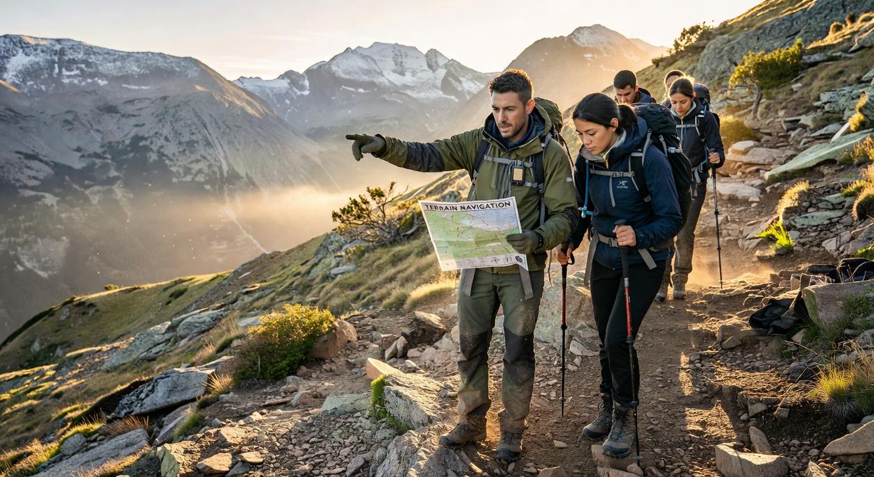
If you’ve ever unfolded a topo map and felt overwhelmed by contour lines, symbols, and elevation markers, you’re not alone. Many outdoor enthusiasts want to feel confident navigating off-grid, but struggle to translate map details into real-world decisions. This guide is built specifically for those looking to master reading topographic maps so they can plan safer routes, identify terrain features at a glance, and move through the backcountry with confidence.
We break down contour intervals, scale, relief, grid systems, and common symbols in clear, practical terms—then show you how to apply them in real navigation scenarios. The goal isn’t theory; it’s usable skill.
To ensure accuracy and reliability, this article draws on established cartographic standards, field-tested navigation practices, and insights from experienced wilderness guides. By the end, you’ll understand not just what the lines mean, but how to use them to make smarter decisions outdoors.
At first glance, a topographic map looks like an indecipherable web of lines and cryptic symbols. I remember thinking it was cartographic spaghetti. The problem is simple: if you can’t decode it, you can’t trust it in the backcountry. This guide turns that confusion into a clear, three-dimensional picture of the land, the single most important skill for safe travel. From my experience, reading topographic maps is less about memorizing legends and more about seeing stories in contour lines. Master this, and you’ll visualize ridges, spot saddles, and navigate with calm confidence. It becomes your most reliable guide out there.
The Anatomy of a Topo Map: Understanding the Legend and Scale
A topographic map is a two-dimensional drawing of a three-dimensional landscape. It uses contour lines—thin, winding lines that connect equal elevations—to show height, slope, and terrain shape. When lines bunch together, land is steep; when they spread out, it’s gentler (your calves will notice the difference).
Practice reading topographic maps.
First, check legend in margin. Map scale, such as 1:24,000, means one unit on the map equals 24,000 of same units on ground. In practical terms, one inch represents 24,000 inches—about 2,000 feet. This ratio scale helps you measure hiking distances accurately.
Next, look for declination, the angle between true north and magnetic north. Because compasses point to magnetic north, you must adjust by listed degrees to stay on course.
Finally, review date and revisions carefully. Trails reroute, roads appear, and bridges wash out, so maps matter for safety.
Decoding Contour Lines: The Language of the Landscape
At first glance, contour lines can look like a bowl of tangled spaghetti. However, once you understand the core rule, the map suddenly makes sense. A contour line connects every point at the same elevation (that is, the same height above sea level). If you walked along that line in real life, you wouldn’t go uphill or downhill at all.
Next, consider the contour interval. This is the vertical distance between one contour line and the next. For example, if the interval is 20 feet, each line represents a 20-foot change in elevation. You’ll usually find this information in the map legend. Without it, you’re guessing—and guessing has no place in serious navigation.
Now to the most important interpretive skill: spacing. Closely spaced lines mean steep terrain—think cliffs or lung-burning climbs. Widely spaced lines signal gentle slopes, meadows, or broad plateaus. In other words, the tighter the lines, the tougher the climb (your calves will confirm).
So how do you spot major terrain features? Hills and mountains appear as concentric closed circles. Ridges form V- or U-shapes pointing downhill. Meanwhile, valleys and drainages create V- or U-shapes pointing uphill, often with a blue line marking a stream.
Admittedly, beginners sometimes mix up ridges and valleys. The trick is to remember that water flows downhill—so the “V” in a valley points upstream.
Mastering these basics turns reading topographic maps from confusing to intuitive—almost like unlocking a hidden level in a video game.
Beyond the Contours: Interpreting Colors and Symbols
When you understand the language of a map, the wilderness stops feeling random and starts feeling readable. That’s the real payoff of reading topographic maps: confidence, faster decisions, and fewer “Are we lost?” moments.
Color-Coding the Terrain
Think of map colors as a quick-reference survival legend:
- Blue: Water features—lakes, rivers, streams, springs. (If it’s blue, it’s life.)
- Green: Vegetation, often indicating dense forest or brush.
- Brown: Contour lines that reveal elevation and slope.
- Black: Man-made features like buildings, trails, and boundaries.
- Red: Major highways and survey lines.
- Purple: Revisions from aerial updates—important when terrain changes.
Knowing this at a glance saves time and helps you plan smarter routes—especially when daylight is fading.
Common Backcountry Symbols
Certain symbols matter more when you’re miles from cell service:
- Trail types: Solid lines often mean established trails; dashed lines may indicate lighter or unmaintained paths.
- Water sources: Springs and intermittent streams (seasonal flow) can make or break a trip.
- Structures: Shelters and cabins offer safety in sudden weather shifts.
- Land features: Marshland warns of soggy footing; mines signal caution.
Pair this knowledge with using a compass correctly a step by step field guide (https://anglehozary.com/using-a-compass-correctly-a-step-by-step-field-guide/) to navigate with precision.
Benefit? You move with purpose, conserve energy, and explore with far more control. (And that’s a game-changer in the wild.)
From Map to Field: Core Navigation Techniques
The foundation of wilderness travel is orienting the map. This means aligning your map so it matches the terrain around you. Place your compass on the map, rotate the map until the magnetic needle aligns with north, and adjust for declination—the difference between magnetic north and true north (listed in the map’s margin). Without this correction, you could drift hundreds of feet off course per mile (which feels small—until you’re cliffed out).
Terrain Association in Action
Terrain association is the art of continuously matching land features to their symbols. When reading topographic maps, look for:
- Creek junctions
- Saddles (low points between peaks)
- Ridgelines and summits
By confirming these features visually, you build constant location awareness. The benefit? Fewer surprises and smarter route choices.
Taking a bearing refines your direction. Point your compass toward a visible landmark, rotate the bezel to align the needle, and read the degree marking. This gives you a precise heading to follow.
If you’re unsure of your position, use triangulation. Shoot bearings to two or three known landmarks, draw those lines on your map, and find their intersection. It’s methodical, reliable, and far more accurate than guessing (which rarely ends well).
You now possess the foundational knowledge to turn abstract lines into real-world awareness. What once looked like spaghetti now reveals ridgelines, valleys, and safe routes. By mastering contours, symbols, and field techniques, you’ve moved past the confusion that frustrates beginners.
Of course, some argue that GPS makes reading topographic maps unnecessary. However, batteries die and signals fade; understanding terrain keeps you oriented when tech fails.
So what’s next? Acquire a topographic map of a familiar park or trail. Then, on your outing, practice terrain association—match what you see to what’s printed. Confidence doesn’t come from theory; it comes from repetition.
Master the Map, Own the Wilderness
You set out to understand how to navigate with confidence — and now you have the tools to do it. From contour lines to elevation changes, from terrain features to route planning, you’ve seen how reading topographic maps transforms uncertainty into clarity.
Out in the backcountry, hesitation can cost you time, energy, and safety. Getting turned around, misjudging elevation, or choosing the wrong route are frustrations every outdoor explorer wants to avoid. The difference between second-guessing and moving with purpose comes down to preparation and skill.
Now it’s time to ACTA: assess your current navigation skills, commit to practicing with real maps, test yourself on varied terrain, and apply what you’ve learned before your next big trip. Don’t wait for a high-stakes moment to wish you had more experience.
If you’re serious about exploring farther and safer, dive deeper into expert backcountry navigation guides and gear recommendations trusted by thousands of outdoor enthusiasts. Equip yourself properly, sharpen your skills, and start planning your next route today. The wilderness rewards those who are prepared — make sure that’s you.